
Google Earth is Best 3D EarthViewer Software, You Can See All Around the World With Google Earth.The world's most detailed globe. The whole world, in your hands. Google Earth, a widely used web-based application developed by Google, offers users the remarkable opportunity to virtually traverse our planet through their computers or mobile devices. This invaluable tool empowers individuals and organizations worldwide by providing access to satellite imagery, 3D representations of buildings, and detailed terrain data. Since its initial launch in 2005, Google Earth has undergone a significant transformation, continually introducing novel features and functionalities that enhance the user's ability to explore and engage with the world around them. In this article, we will explore the history, features, and benefits of Google Earth. History of Google EarthThe history of Google Earth is a fascinating journey through time, technology, and innovation. It all began in 2005 when Google introduced its desktop application, Google Earth, which quickly captured the imagination of users worldwide. This innovative tool provided access to satellite imagery of Earth's surface, opening up a new world of exploration and discovery. In its initial iteration, Google Earth not only offered breathtaking satellite views but also included practical features like distance and area measurement tools, as well as location search capabilities. This made it a valuable resource for both casual users and professionals. As time progressed, Google Earth underwent significant transformations, expanding its capabilities and partnerships. Google collaborated with various organizations and harnessed cutting-edge technology to enhance the platform. One major milestone came in 2010 when Google unveiled a new version of Google Earth, allowing users to delve into the depths of the ocean. This development brought underwater terrain to life in 3D, enriching the platform's capacity for exploration. Beyond serving as a tool for viewing the Earth's surface, Google Earth has evolved into a multifaceted platform. It introduced 3D renderings of buildings, terrain, and street-level imagery, providing a more immersive experience. This evolution has made it a versatile and educational tool, enabling users to learn about geographical features and historical landmarks. In recent years, Google Earth has transcended its original purpose. It has become a hub for education, exploration, and even activism. Users utilize the platform to raise awareness about critical environmental issues and share information about cultural and historical sites. This transformation highlights Google Earth's significance as not just a technological marvel but also as a means for positive global impact. In conclusion, Google Earth's history is a testament to human ingenuity and the endless possibilities of technology. From its humble beginnings in 2005, it has evolved into a multifunctional, educational, and enlightening tool that empowers users to explore, learn, and make a difference in the world. Features of Google EarthGoogle Earth offers an array of impressive features for users to embark on captivating journeys around the globe. Some of the key features include: Satellite Imagery: Google Earth provides access to high-resolution satellite imagery, enabling users to zoom in and out to view specific locations in exquisite detail or take in the entirety of our planet. 3D Buildings: In addition to satellite images, Google Earth boasts 3D models of buildings and renowned landmarks, enhancing the exploration of cities and tourist hotspots. Street-level Imagery: With street-level imagery, users can virtually stroll through cities and towns, gaining a ground-level perspective of different places. Layers: Google Earth allows users to add layers to their maps, offering information on weather conditions, traffic, and real-time earthquake data. Historical Imagery: The "historical imagery" feature permits users to access satellite images from various time periods, enabling a visual comparison of how a location has evolved over time. Benefits of Google EarthGoogle Earth offers a multitude of advantages for both individuals and organizations, including: Education: Google Earth serves as a dynamic educational tool, fostering a visual and interactive approach to learning about geography, history, and diverse cultures. Planning: For travelers and event planners, Google Earth aids in pre-trip exploration, providing a preview of a location's appearance. Research: Researchers and scientists find Google Earth invaluable for in-depth analysis of the Earth's surface, contributing to studies on topics such as climate change and urban development. Environmental Activism: Google Earth supports environmental activism by enabling users to share information about environmental issues and raise awareness about human impact on the planet. Accessibility: With internet access, Google Earth is accessible worldwide, facilitating exploration of the Earth's diversity and cultures, regardless of geographical location. Applications of Google EarthGoogle Earth finds application across a spectrum of industries and fields: Education: Educational institutions employ Google Earth for teaching geography, history, culture, and environmental issues, offering an immersive learning experience. Travel and Tourism: Travel enthusiasts use Google Earth to plan trips and explore destinations before embarking on their journeys. Travel companies utilize it to showcase attractions to potential travelers. Real Estate: Real estate agents utilize Google Earth to showcase properties and provide potential buyers with a visual tour of the surrounding area. Research and Development: Researchers and scientists rely on Google Earth to collect data on various topics, ranging from urban development to climate change. Environmental Activism: Environmental activists harness Google Earth to raise awareness about ecological concerns and the Earth's vulnerability to human activities. Conclusion In conclusion, Google Earth is a powerful tool that allows users to explore the world in new and exciting ways. With its range of features and applications, Google Earth has become an invaluable resource for individuals and organizations across various industries and fields. Whether you are a student, a traveler, a researcher, or an environmental activist, Google Earth has something to offer. As the platform continues to evolve, we can expect to see even more innovative features and applications in the future. 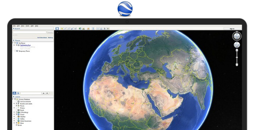
Screenshot
System Requirements:
Windows 7 / Windows 8 / Windows 8.1 / Windows 10 / Windows 11
Date Added:29-Jul-2023 License:Free Languages:English, German, Japanese, Polish, Spanish, French, Italian, Chinese Developer By:Googlehttps://www.google.com |


Relative Softwares |
|---|